Table of Contents
AiGIS2/PyAiGIS
AiGIS2/PyAiGIS is an our new project that aims to develop an interactive analysis and visualization environment for irregular-shaped small body exploration data on Jupiter Notebook with Python.
As we introduced our preliminary achievements in the following meeting,
- Nagayoshi and Hirata (2022) AiGIS2, a Jupyter Notebook-based Interactive Analysis and Visualization Tool for Asteroid Exploration Data, AGU Fall Meeting 2022, held in Chicago, IL, 12-16 December 2022, id.P25F-2187.
- Nagayoshi and Hirata (2023) AiGIS2, Interactive, Versatile Analysis and Visualization Tool for Asteroid Exploration Data, AGU Fall Meeting 2023, P33F-3207.
- Hirata and Nagayoshi (2024) AiGIS2/PyAiGIS, A Python-based Interactive Analysis And Visualization Tool For Asteroid Exploration Data, LPSC 55, #1877
GitHub project/repositories
- GitHub project: https://github.com/AiGIS-PyAiGIS/
- Repository for ipynb samples: https://github.com/AiGIS-PyAiGIS/PyAiGIS-examples
- Repository: https://github.com/AiGIS-PyAiGIS/PyAiGIS
- Currently a README.md is only available.
Technologies
AiGIS2/PyAiGIS is developed with the following technologies:
Screenshots
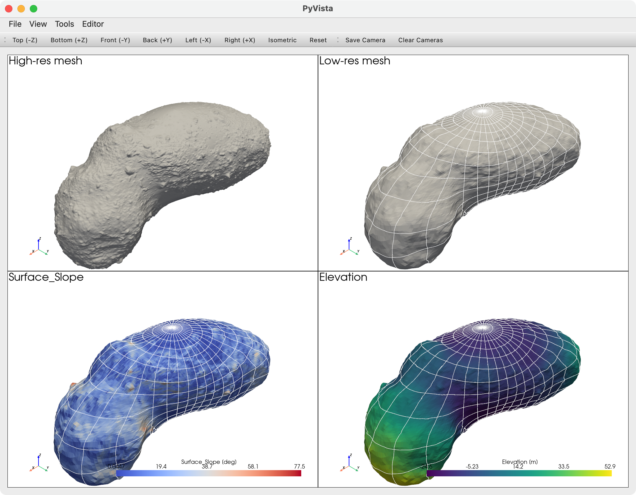
Examples of visualization of Itokawa shape and associated mapdata by AiGIS2/PyAiGIS.
Multi-view visualization of Itokawa shape and associated mapdata.
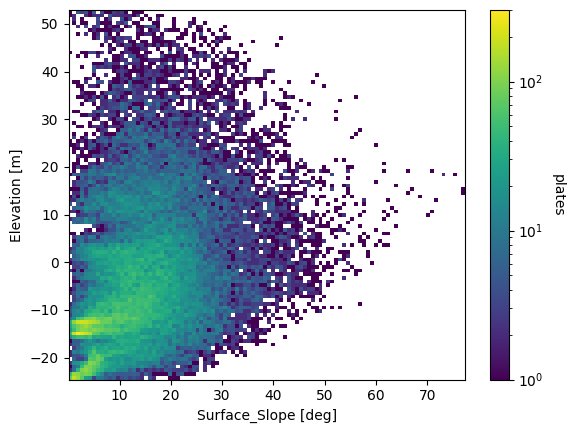
2D distribution plot of the surface slope and elevation of Itokawa mapdata by Matplotlib.
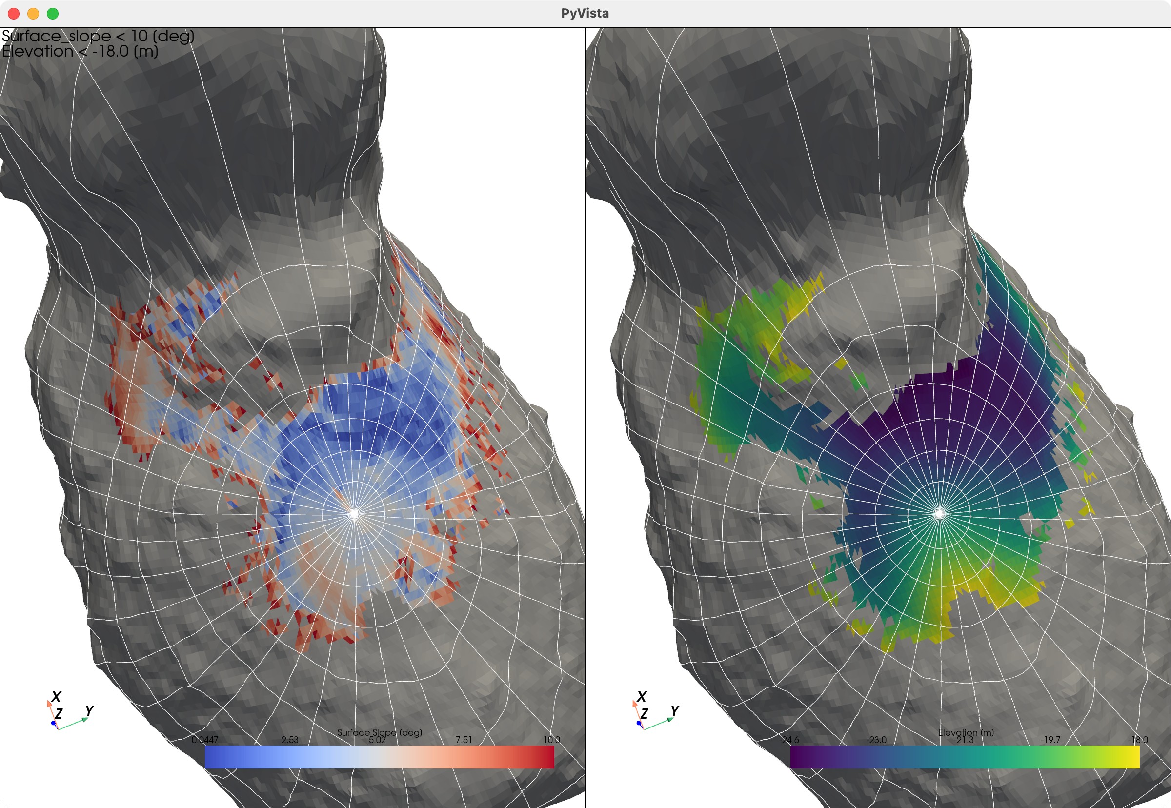
Smooth terrain on Itokawa (regions where the slope is < 10 [deg] and the elevation is < -18 [m] are colored).
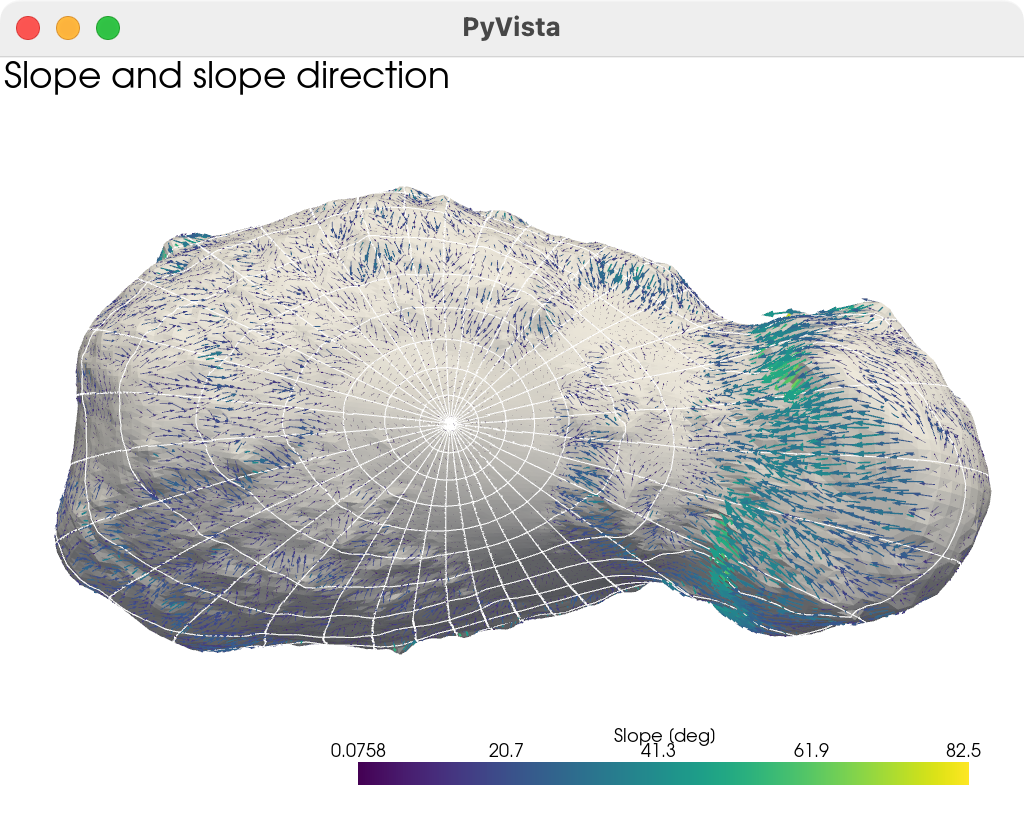
Slope distributions on Itokawa (slope directions and slopes are visualized with arrows).
Contact
Please send your questions and comments to Naru Hirata (naru@u-aizu.ac.jp) or our group mail address (arcspace@u-aizu.ac.jp).
Acknowledgements
AiGIS2/PyAiGIS is developed as a research project by students at the University of Aizu.
The project is/was supported by:
- ARC-Space, the University of Aizu, Distinctive Joint Research Center supported by MEXT Grant Number JPMXP0619217839/JPMXP0622717003/JPMXP0723830458.


