Table of Contents
AiGIS
Overview
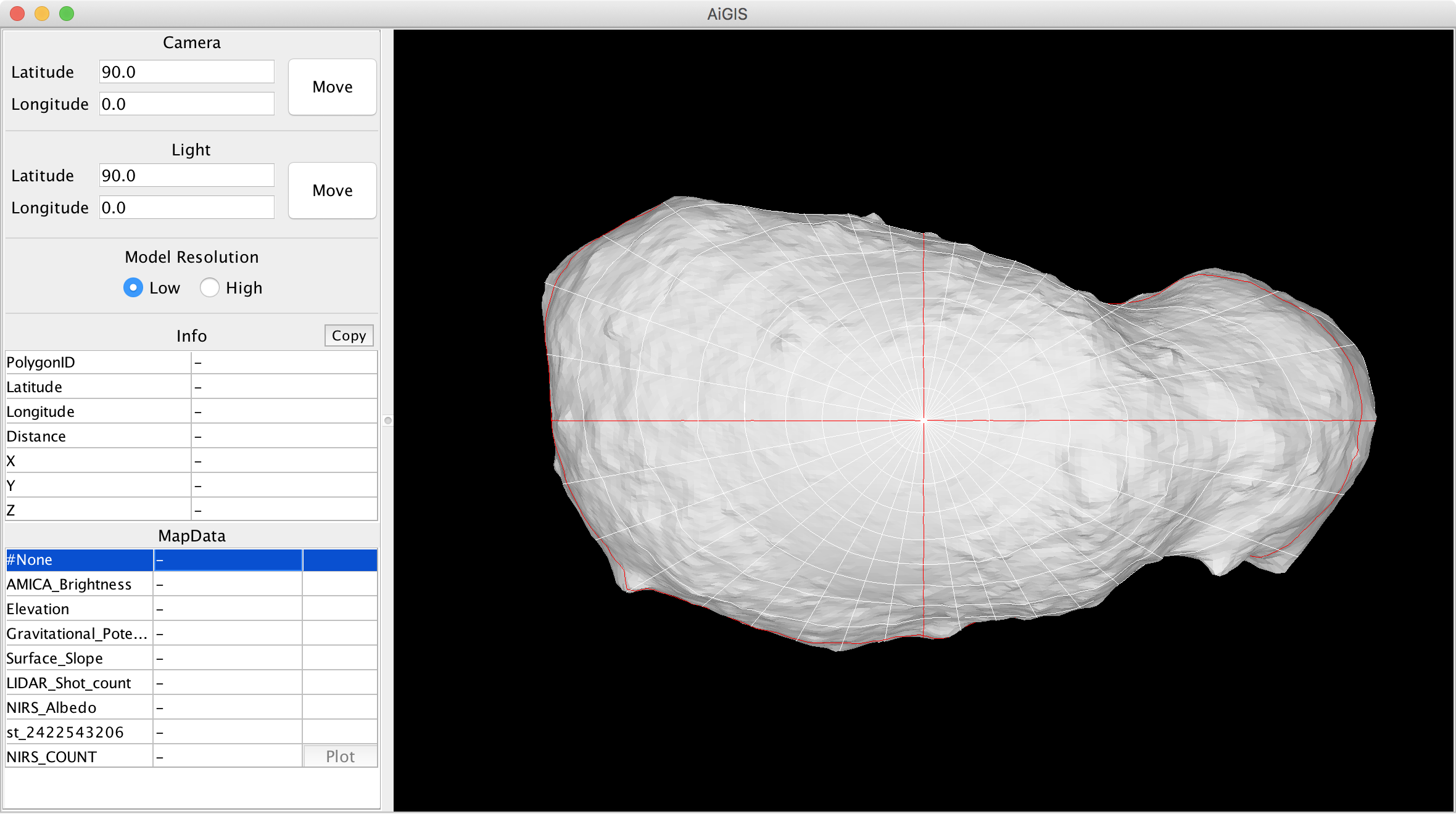
AiGISは小惑星などの不規則な形状を持つ天体の探査データを解析するために開発された三次元地理情報システム(3D-GIS)です.天体の形状をポリゴンモデルで表現し,天体表面の地理情報を各ポリゴンに割り当てたIDで管理することができます.AiGISは天体の形状,地理情報,地図画像を可視化した上で,画面上で自由に操作することができます.
ダウンロード
最新版
- 2025/04/28版
- Mac: AiGIS_v20250428_mac.zip
- Linux: AiGIS_v20250428_linux.zip
- Windows: AiGIS_v20250428_win.zip
- JAR: AiGIS_v20250428_jar.zip
ソースコードを閲覧したい場合はご連絡ください.
リリースノート: 2025/04/28
- 画像貼り付け時にカメラの視野錐台を表示する機能を追加しました
- 画像貼り付け時のバグを修正しました
- マップデータ取り扱いに関する複数のバグを修正しました
過去の版
過去の版はこちらからダウンロードできます.
サンプルデータセット
AiGISは所定の形式でディレクトリ中に必要なデータを格納したデータセットを読み込んで動作します.サンプルデータセットを以下からダウンロードできます.
これらのデータセットはAiGISの動作確認や広報のためのサンプルとして配布しています.学術的研究に必要な質の担保はありませんのでご注意ください.AiGIS用のデータセットの詳細は本ページの後半をご覧ください(英語のみ).
ユーティリティ
緯度経度グリッドデータ生成ツール
使用方法
起動
- AiGISの起動時には読み込み対象とするAiGIS用データセット一つを指定する必要があります
- 初めてAiGISを使う場合は上記で配布しているサンプルデータセットをお試しください
- macOS環境では,データセット指定のダイアログでディレクトリ構造が通常のものと異なる形で表示されることがあります.その場合,AiGISをダウンロードした場所から任意の場所に移動させてから再度AiGISを起動してください
- Windows環境ではAiGISの初回起動時に管理者権限での認証を要求される場合があります
- 同じくWindows環境ではAiGISの初回起動時にVC++ライブラリのインストールを要求される場合があります.その場合,VC++ライブラリのインストールを行ってから再度AiGISを起動してください
- macOS環境ではAiGISの初回起動時にOSのシステム環境設定で管理者権限での認証を要求される場合があります
データ
- AiGISはデータセット中のWavefront objectフォーマット (.obj) の形状モデルを読み込んで動作します
- 2種類の異なる形状モデル(低解像度のモデルと高解像度のモデル)を同時に読み込んで,表示を切り替えることができます
- 何らかの操作を行う際には表示が自動的に低解像度モデルに切り替わり,計算機の負荷を軽減します
- 1種類のみの形状モデルしか含まないデータセットを使用することも可能です.この場合,このモデルは低解像度モデルとして取り扱われます
モデル操作
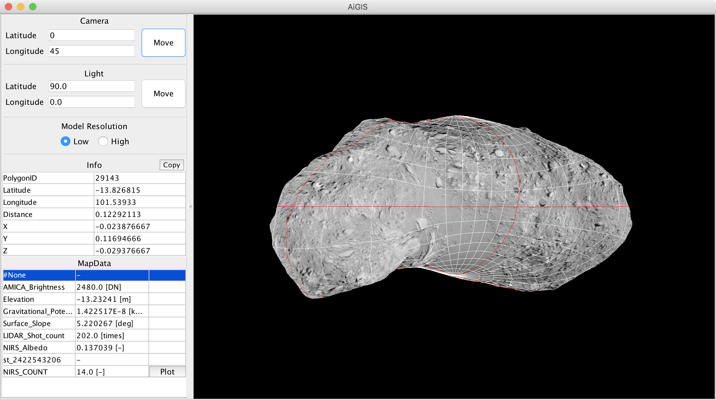
- 表示された天体をマウス操作(右ボタンをクリックしたままマウスを動かす)で回転させ,表示方向を変えるることができます
- シフトキーを押し下げながらマウス操作をすると,光源の方向を変えることができます
- オプションキーを押し下げながらマウス操作をするか,ホイール操作で表示の拡大・縮小を行うことができます
- コントロールキーを押し下げながらマウス操作をすると,表示された天体を上下左右に移動させることができます
- X,Y,Zのいずれかのキーを押し下げながらマウス操作をすると,回転の軸を固定することができます
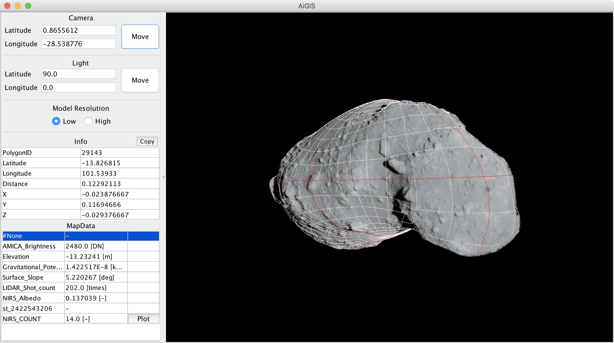
- メインウィンドウのCameraとLightの数値をキーボードで書き換えて横のボタンをクリックすると,天体の表示方向と光源の方向を任意に変えることができます
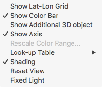
- View>Shadingのチェックを外すと,照明による影付けを行わないようにできます
- グレイスケールの地図データを表示する際に便利です
- View>Fixed Lightにチェックを入れると,天体の表示方向を回転させても光源の相対的な方向が変化しないよう,固定することができます
- View>Reset viewで表示を初期状態に戻すことができます
マップデータ
データセット中に含まれるポリゴンごとの数値情報をAiGISではマップデータと呼びます
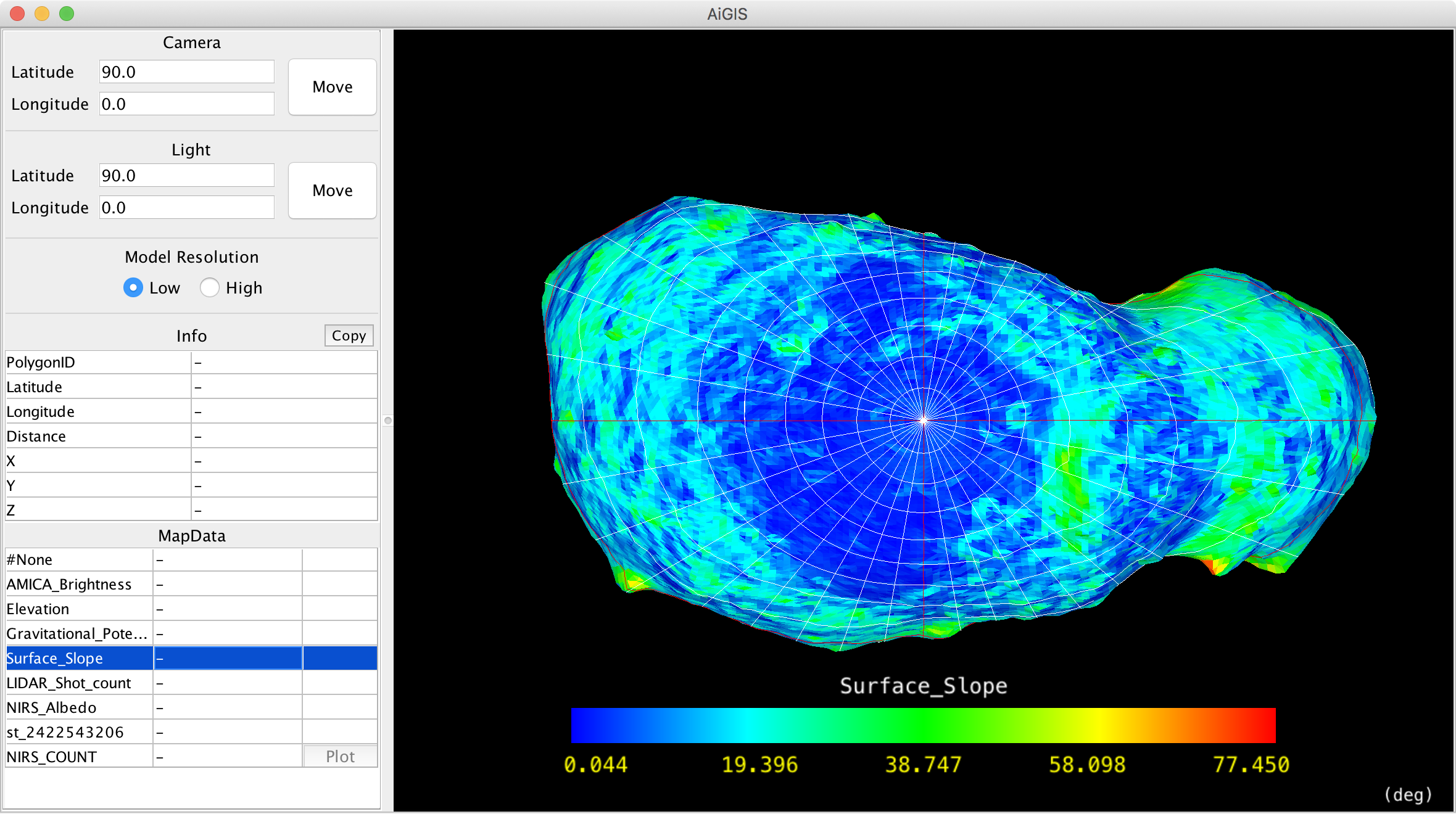
- メインウィンドウ左下のマップデータリストの中から表示したいデータを選択します
- マップデータ中の情報がポリゴンの色に対応します
- 上下の矢印キーで表示するマップデータ切り替えをすることもできます
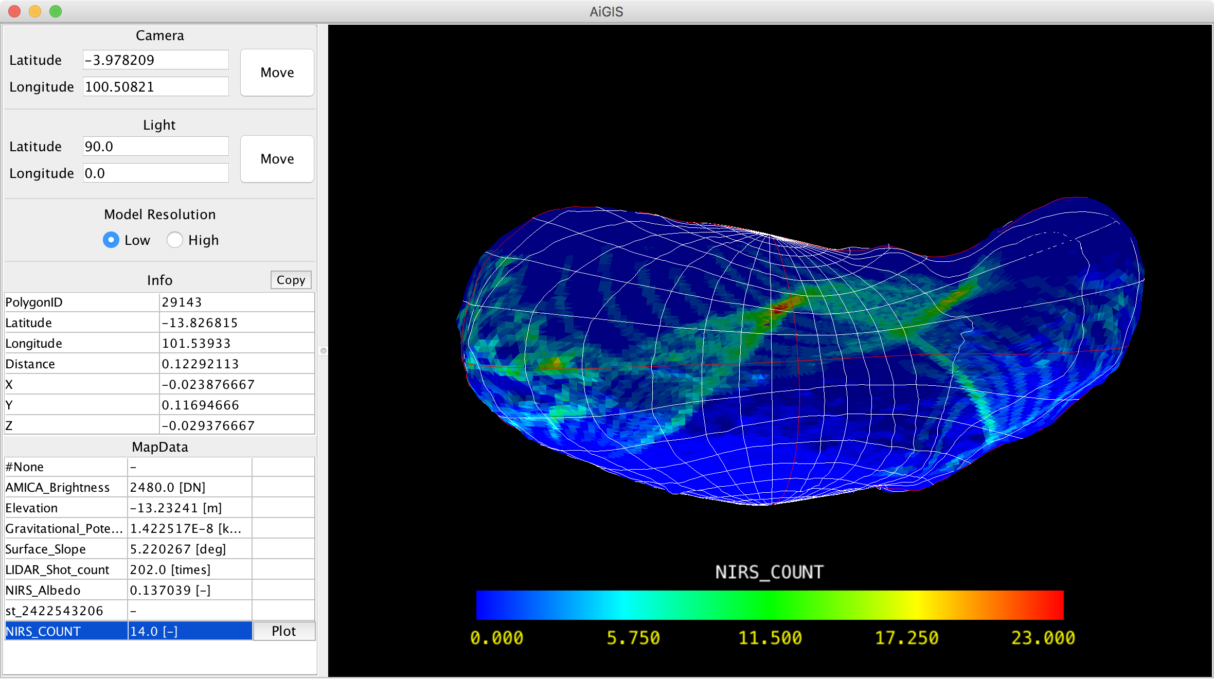
- 天体上で興味のある地点をクリックすると,その地点を含むポリゴンが強調表示されるとともに,Info欄にその地点の位置情報とマップデータから読み取った数値が表示されます
- Info欄の数値情報はCopyボタンでコピーできます
- マップデータ色割り当て(look-up-tables, LUT)は,デフォルトでは虹色とグレイスケールから選択することができます(View>Look-up Table)
- ユーザ自身が定義したLUT設定を取り込むことも可能です.下記のユーザ定義LUTの項を見てください
- View>Rescale Color Rangeでマップデータの数値情報とLUTによる色割り当てを変更することができます
- MapData>Sort By Name/By FileNameでマップデータリストの表示順を変えることができます
- MapData>Reloadでデータセット中のマップデータファイルを再読み込みできます(形状モデルの再読み込みは行われません)
ユーザ定義LUT
ユーザ自身が定義したLUT設定を取り込むことが可能です.詳細は以下の記述(英語)を参考にしてください.
- Definition of a LUT should be described in the txt format appeared in Scientific colour-maps by F. Crameri
- Place your LUTs in a directory
- Path to the directory with user-defined LUTs should be defined in LookUpTablePath of the Setting dialog (“File>Settings…”)
- List of the user-defined LUTs will appeared in Look-up Table menu (“View>Look-up Table”)
グラフマップデータ
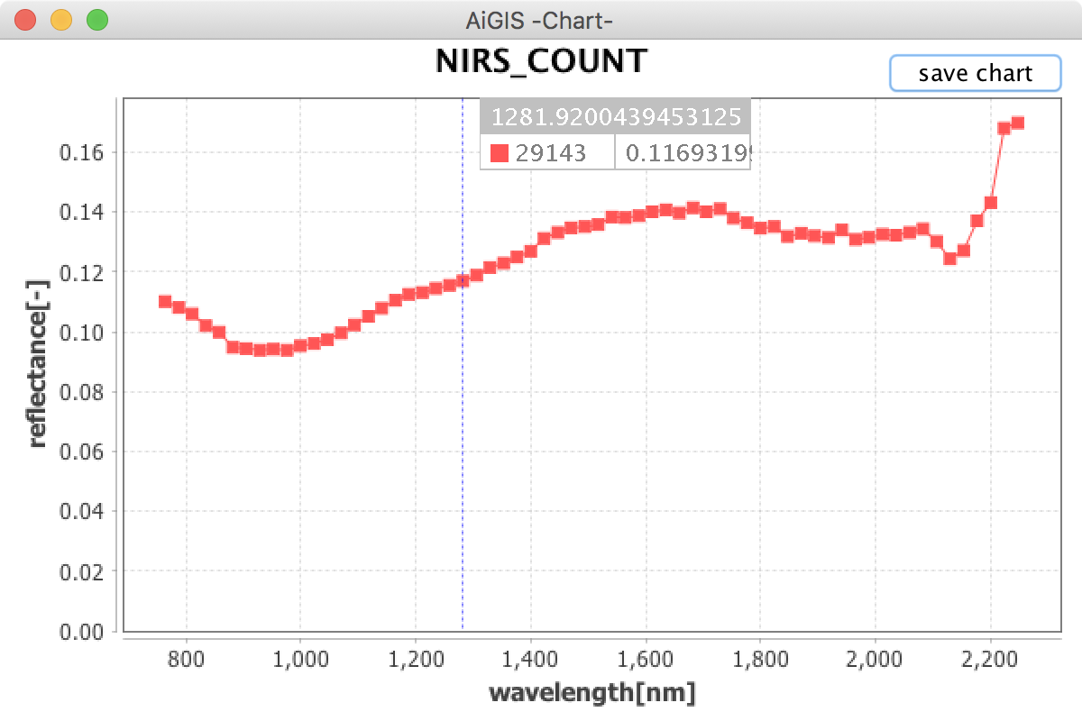
ポリゴンごとにグラフを作成可能な2次元の数値情報をAiGISではグラフマップデータと呼びます.本サイトで配布しているイトカワのサンプルデータには近赤外分光器NIRSの観測データを源泉としたグラフマップデータが含まれています.グラフマップデータは必ずいずれかのマップデータと関連づけられています.
- グラフマップデータと関連づけられたマップデータ(リスト中にPlotボタンが表示されています)を選択します
- イトカワサンプルデータではNIRS_COUNTがNIRS観測データのグラフマップデータと関連づけられています
- 天体上で興味のある地点をクリックします(その地点を含むポリゴンが強調表示されます)
- マップデータリストのPlotボタンをクリックすると,グラフが独立したウィンドウで表示されます
- 追加で別の地点をクリックするとその場所のグラフが追加されます
- データのない地点(サンプルデータではNIRS_COUNTが0の地点)を選んでも何も表示されません
- グラフウィンドウのsave chartをクリックすると,グラフの源泉数値情報を書き出すことができます
画像・地図画像のマッピング
探査機が撮影した画像や,そこから作った地図画像を天体表面に貼り付けて表示することができます.
- Image>Open Image/Map Image…で貼り付けたい画像を決定するダイアログが開きます
- 貼り付け表示可能なのは,撮影情報(撮影時の探査機位置・姿勢情報,INFO形式またはSUM形式)が付属する画像,または正距円筒図法の地図画像です
- jpg,pngなどの一般的な画像フォーマットのほか,FITS形式の画像データにも対応しています
- 画像を貼り付ける際には,画像ファイルと対応する撮影情報ファイルのペアをダイアログ上で指定します(サンプルデータセットにはimagesディレクトリに拡張子だけが異なるペアのファイルが含まれています)
- 地図画像を貼り付ける場合は,ダイアログでMapを選択した上で,地図画像ファイルのみを指定します
- 画像・地図画像を貼り付ける際に回転・反転の選択ができます.正しく貼り付けられない場合はこの機能を試してみてください(サンプルデータセットの画像・地図画像は回転なし,反転なしで正しく貼り付けられるようになっています)
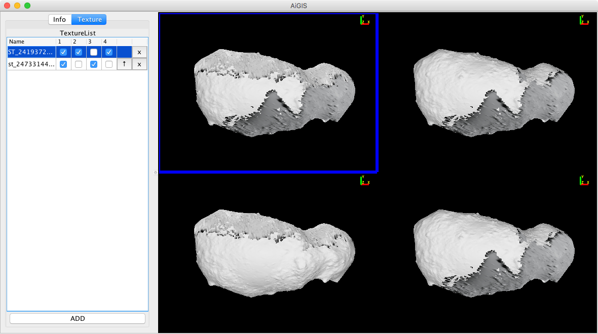
- Imagesタブで読み込み済みの画像・地図画像の表示・非表示の切り替えや,貼り付け順番の調節,読み込みの解除を行うことができます
- 撮影情報のデータフォーマット
- INFO形式: ジョンズホプキンス大学応用物理学研究所(APL/JHU)で開発された小惑星探査データ解析ツールSmall Body Mapping Tool (sbmt) で採用されている形式です.sbmtから出力されたINFO形式の撮影情報をAiGISで利用することができます.また,INFO形式の撮影情報を生成するツールを後日提供予定です
- SUM形式: R. Gaskell氏が開発した形状モデル復元ソフトStereophotoclinometry (SPC) で採用されている形式です
- 画像・地図画像は最大で同時に6枚まで読み込み・貼り付け可能です
- 限度を超えた場合はImagesタブで読み込み解除をすることができます
マルチビューモード
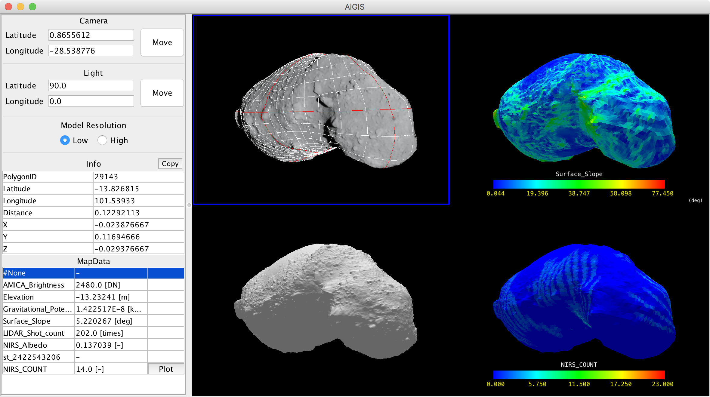
AiGISは画面を二つまたは四つに分割し,異なるマップデータなどを同じ視点で比較することができるモードを備えています.
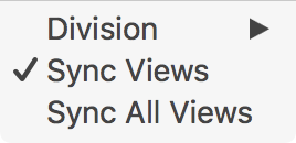
- Multi-View>Division>1/2/4で2または4を選択すると,マルチビューモードに入ります
- マルチビューモードでは,マップデータの切り替えなどの操作を行う対象のビューをクリックで選択できます(選択中のビューは青枠で強調表示されます)
- 回転などのモデルの操作は全てのビューに同時に適用されます
- Multi-View>Sync Viewsのチェックを外すと,モデルの操作が選択中のビューにのみ適用されるようになります
- Multi-View>Sync All Viewsで選択中のビューに適用されたモデルの操作が他のビューにも適用されます
初期設定
データセットのデフォルトディレクトリ,スナップショット画像書き出し先ディレクトリ,グラフの源泉数値情報の書き出し先ディレクトリ,ユーザ定義LUT設定ファイルの配置ディレクトリは,File>Settings…で設定することができます.
設定項目
- DefaultDataPath: データセットのデフォルトディレクトリ
- SavePngPath: スナップショット画像書き出し先ディレクトリ
- SaveGraphDataPath: グラフの源泉数値情報の書き出し先ディレクトリ
- LookUpTablePath: ユーザ定義LUT設定ファイルの配置ディレクトリ
- Windows環境の場合,ディレクトリ設定のパス表記で,
\を二重に記載する必要があります- 例: ’C:’にディレクトリを設定したい場合は’C:\Users\CurrentUserName\AiGISData’と記載する
メニュー項目機能
File メニュー
- Open…: 新たなデータセットを読み込む
- Save Snapshot: メインウィンドウの天体の表示部分のスナップショット画像を保存する.保存先は初期設定のPngPathで設定したディレクトリになる
- Setting…: データセットのデフォルトディレクトリなどの初期設定を行う
- About…: 本ソフトについてを表示
View メニュー
- Show Lat-Lon Grid: 緯度・経度グリッドの表示・非表示切り替え(グリッドデータはあらかじめ用意しておく必要がある)
- Show Color Bar: マップデータ表示時のカラースケールの表示・非表示切り替え
- Show Additional 3D object: 任意の3Dオブジェクトを読み込み,表示する(試験中機能)
- Rescale Color Range: マップデータ色割り当ての調整
- Look-up Table: LUTの切り替え
- Shading: 照明による影付けの切り替え
- Reset view: 表示の初期化
- Fixed Light: 光源の相対的方向の固定
Multi-View メニュー
Image メニュー
MapData メニュー
問い合わせ先
AiGISに関する問い合わせは会津大学宇宙情報科学研究センター (arcspace@u-aizu.ac.jp) または同センターの平田成 (naru@u-aizu.ac.jp) までご連絡ください.
以下の技術的情報は現在英語のみでの提供になっています.質問がある場合は問い合わせ先にご連絡ください.
Data format
Map data
Sample: Itokawa_elevation_64.txt
#Data Name (Appeared on the Map data list)
Elevation
#Unit (or description)
[m]
#The Number of Polygons
49152
#Polygon_ID Value (Tab and Space is allowed as delimiter)
1   -3.451888084411621
#Continue for all polygones
2   -3.431725025177002
3   -3.906290054321289
4   -4.018442153930664
5   -4.496425151824951
Notes on Map data
- No duplicated Data Name is allowed for map data for a model
- Hyphen '-' can be used when no value is available on a certain polygon
- A line starting '#' is treated as comments in Map data, Graph map data, and Shape models
Graph map data
Sample: nirs_spcmap_051116.txt (NIRS Spectra)
#Name of Map data that the graph map data is associated
NIRS_COUNT
#Unit (or description) for the X-axis
reflectance[-]
#Unit (or description) for the Y-axis
wavelength[nm]
#The Number of Polygons
49152
#_ Values for the X-axis (1st column should be '_') ...
_ 2247.88 2224.32 2200.76 2177.20 ...
#Polygon_ID Values for the X-axis ...
1 0.000000 0.000000 0.000000 0.000000 ...
#Continue for all polygones ...
2 0.000000 0.000000 0.000000 0.000000 ...
Notes on Graph Map data
- Lines starting '#' are treated as comments in Graph map data, Map data, and Shape models
Data set structure
Minimum contents of the data set directory for AiGIS are as follows:
- AiGIS_setting.txt
- Shapemodel directory
- MapData directory
- MapDataHigh directory
The Shapemodel directory is usually used to place shape models and gird data, but they can be placed outside this directory. Files in MapData and MapDataHigh directories are assumed and try to load as map data for the SHAPE and SHAPEHIGH models respectively.
If a data set have 3 or more shape models, these directories will be assessed to load map data for additional shape models:
- MapData1 for the SHAPE1 model
- MapData2 for the SHAPE2 model
- same for MapData3, 4, …
- MapDataHigh1 for the SHAPEHIGH1 model
- MapDataHigh2 for the SHAPEHIGH2 model
- same for MapDataHigh3, 4, …
Items in AiGIS_setting.txt
All items in AiGIS_setting.txt are described in KEY = VALUE style. Multiple VALUES may be assigned in the following format
KEY = VALUE1,VALUE2,VALUE3
- SHAPE (mandatory)
- Path to the low-resolution shape model in the relative path style from the directory placed AiGIS_setting.txt
- SHAPEHIGH (optional)
- Path to the high-resolution shape model.
- GRIDR/GRIDW (mandatory)
- Path to the latitude-longitude grid data. The same grid data will be applied both the low-resolution and high-resolution models. Because this items are mandatory, you may prepare dummy grids for shape models that grids are unavailable.
- CHANGEMODEL (optional)
- TRUE or FALSE to control automatic change of displayed model while model manipulation. The low-resolution model is displayed while model manipulation when CHANGEMODEL is TRUE even the high-resolution model is selected to be displayed.
- MAPDATA/MAPDATAHIGH (optional)
- Path to additional map data for the low-resolution model and high-resolution model not placed in MapData/MapDataHigh directories, respectively. Multiple values are accepted.
- CHARTDATA (optional)
- Path to graph map data. Error will be occurred when a graph map data doesn't have an associated map data
- GRID (optional, this keyword may be renamed in future)
- Path to directory containing data of additional 3D objects
- IMAGEMAPDIR (optional)
- Path to directory containing image data and relating geometry information files
If a data set have 3 or more shape models, the following KEYs can be used:
- SHAPE1, SHAPE2 …
- SHAPEHIGH1, SHAPEHIGH2 …
Keywords MAPDATA, MAPDATAHIGH, MAPDATADIR, MAPDATADIRHIGH and CHARTDATA can also be sequentially numbered for numbered shape models.
The numbered two models (e.g. SHAPE1 and SHAPEHIGH1) will be paired for the CHANGEMODEL function.
History
- 2023/11/17
- Support multiple (3 or more) shape models
- Support macOS Ventura and Sonoma
- 2023/01/15
- Fix bugs relating shape model handling
- 2019/11/11
- Support FITS image (including multibyte image)
- Support SUMFILEs of SPC as imaging geometry information
- Support user-defined look-up-tables (LUT)
- 2019/03/10
- Improved image mapping capability with multi-image mapping
- Quick reloading of map data
- Fixed lighting mode
- Fixed-axis rotation mode
- Reorganized preference setting feature
- 2018/07/17
- Improve multi-view mode with high-resolution shape models
- Rebuild user interfaces
- Fix several bugs
- 2018/03/15
- Initial release
Contact
Please send your questions and comments to Naru Hirata (naru@u-aizu.ac.jp) or our group mail address (arcspace@u-aizu.ac.jp).
Reference
Acknowledgements
AiGIS was originally developed as a research project by students at the University of Aizu.
The project is/was supported by:
- JSPS KAKENHI Grant Number 17K05639, “FY2017-19 Coordination Funds for Promoting AeroSpace Utilizaiton MEXT, Japan”
- ARC-Space, the University of Aizu, Distinctive Joint Research Center supported by MEXT Grant Number JPMXP0619217839/JPMXP0622717003/JPMXP0723830458.
- Collaborative research between JLPEDA/JAXA and the University of Aizu.
Aizu Laboratory, Inc. supports development and maintenance of the software.
